


CALHOUN TWP Voting District, Calhoun County, Iowa
About
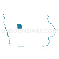
Outline

Summary
| Unique Area Identifier | 581623 |
| Name | CALHOUN TWP Voting District |
| County | Calhoun County |
| State | Iowa |
| Area (square miles) | 31.61 |
| Land Area (square miles) | 31.60 |
| Water Area (square miles) | 0.01 |
| % of Land Area | 99.97 |
| % of Water Area | 0.03 |
| Latitude of the Internal Point | 42.25366150 |
| Longtitude of the Internal Point | -94.66707770 |
Maps


Graphs
Select a template below for downloading or customizing gragh for CALHOUN TWP Voting District, Calhoun County, Iowa


Neighbors
Neighoring Voting District (by Name) Neighboring Voting District on the Map
- CEDAR TWP Voting District, Greene County, IA
- ELM GROVE TWP Voting District, Calhoun County, IA
- JACKSON TWP Voting District, Calhoun County, IA
- JASPER TWP Voting District, Carroll County, IA
- LAKE CITY Voting District, Calhoun County, IA
- LAKE CREEK TWP Voting District, Calhoun County, IA
- LOGAN TWP Voting District, Calhoun County, IA
- SHERIDAN TWP W/O LIDDERDALE Voting District, Carroll County, IA
- UNION TWP Voting District, Calhoun County, IA
Top 10 Neighboring County Subdivision (by Population) Neighboring County Subdivision on the Map
- Lake City city, Calhoun County, IA (1,727)
- Union township, Calhoun County, IA (468)
- Sheridan township, Carroll County, IA (427)
- Jasper township, Carroll County, IA (307)
- Jackson township, Calhoun County, IA (229)
- Elm Grove township, Calhoun County, IA (164)
- Cedar township, Greene County, IA (158)
- Calhoun township, Calhoun County, IA (139)
- Lake Creek township, Calhoun County, IA (128)
- Logan township, Calhoun County, IA (115)
Top 10 Neighboring Place (by Population) Neighboring Place on the Map
Top 10 Neighboring Unified School District (by Population) Neighboring Unified School District on the Map
Top 10 Neighboring State Legislative District Lower Chamber (by Population) Neighboring State Legislative District Lower Chamber on the Map
Top 10 Neighboring State Legislative District Upper Chamber (by Population) Neighboring State Legislative District Upper Chamber on the Map
Top 10 Neighboring 111th Congressional District (by Population) Neighboring 111th Congressional District on the Map
Top 10 Neighboring Census Tract (by Population) Neighboring Census Tract on the Map
- Census Tract 9601, Carroll County, IA (3,882)
- Census Tract 9504, Calhoun County, IA (2,398)
- Census Tract 805, Greene County, IA (1,849)
- Census Tract 9503, Calhoun County, IA (1,796)